
#OnePlaceMaps - uses
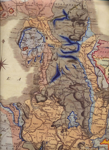
Starting at the beginning, geological maps give an idea of what is under the ground and this drives what is on the ground, the use to which this is put and the subsequent development of the place. This 1820s geological map illustrates the local coal seams, exploitation of which formed a significant part in the history of the area.
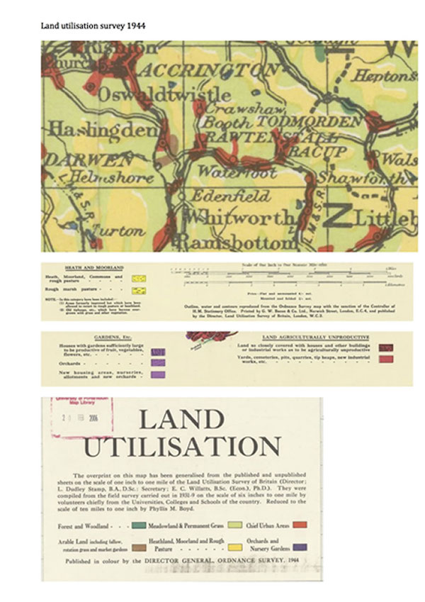
The relation between geology and land use is illustrated by this land utilisation detail from 1944:
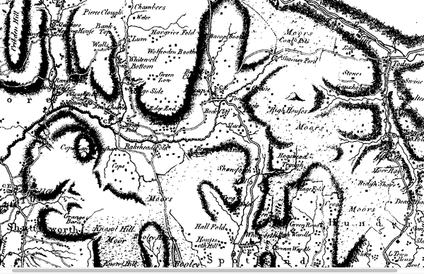
Maps were made for a purpose and the content reflects what the original cartographer thought was worth recording and depicting. C16 and C17 maps tend to show little detail of the area, not entirely surprising as it was relatively under developed at the time. This extract from the Yates 1786 map illustrates Cloughfold including Polefield Cottage (dated 1642) towards the left of the map and is the earliest I have found which shows Cloughfold itself (of which Springhill is part).
One can then trace the development of the area be comparing the OS maps over time (many of these are available on the National Library of Scotland site). A high scale OS map can also form the source of a database of features of the area, both buildings and others depending on interest.
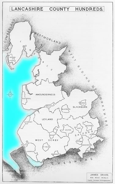
Maps illustrating administrative boundaries give an indication of the influences on the communities. Few are contemporary for this area, but all are illustrative. For Springhill this includes the ancient hundreds:
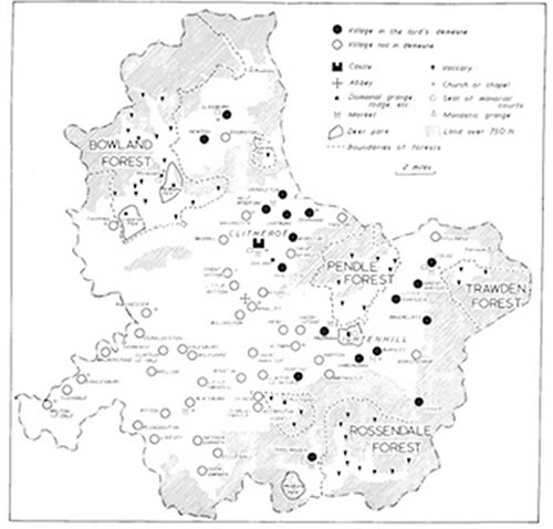
the extent of the manor (known as the Honor of Clitheroe), including the area under Forest Law:
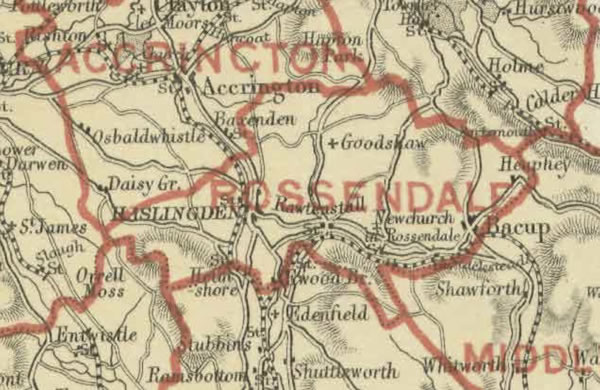
or parliamentary constituencies, this one being 1886:
As well as indicating the political and other influences on an area, these give some idea of where records may be found, or how they may be catalogued.
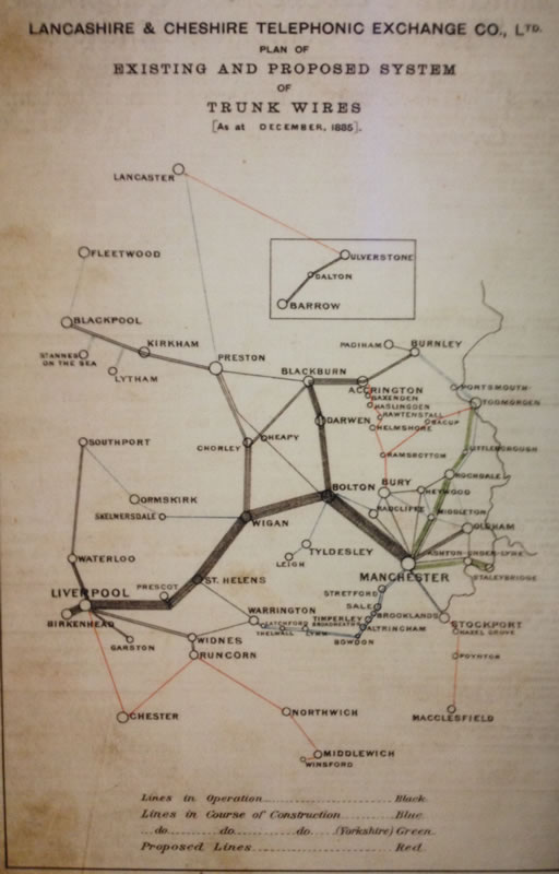
Patterns of development can be illustrated by the utilities set up to serve them. These may be formally provided, e.g. the telegraph network:
or informal, such as Charles Patrick's pipe network bringing the water from Saunder Height to his properties in Springhill:
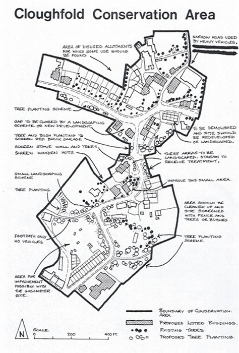
Other plans were drawn up to support government initiatives, whether the 1910 valuation survey (finding out what existed with the intention of taxing it) or the 1941 national farm survey (finding out what existed with the purpose of seeing if it could be made more efficient) which often included plans of the farms in question. Local government consultations often come with plans of the area, this example being the Cloughfold Conservation Area 1975.
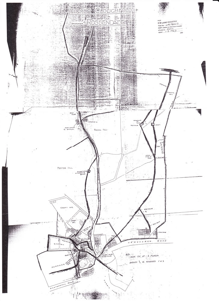
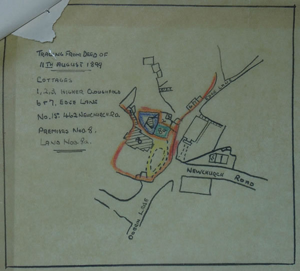
Of course maps and plans have long been used to illustrate title, whether old deeds such as this one from 1899 or recent Land Registry documents.
Beware however that the Land Registry plans aren't necessarily correct. Taking this extract for example, the Cottage isn't where it appears to be, Sunset View isn't that big and 3 Springhill doesn't exist…

Less formal plans may be used to illustrate research progress, examples being these illustrating some of the churches in Rossendale
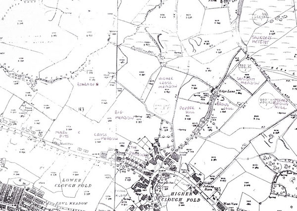
field names reconstructed from documents:
or the outline of Sion Baptist Church graveyard:

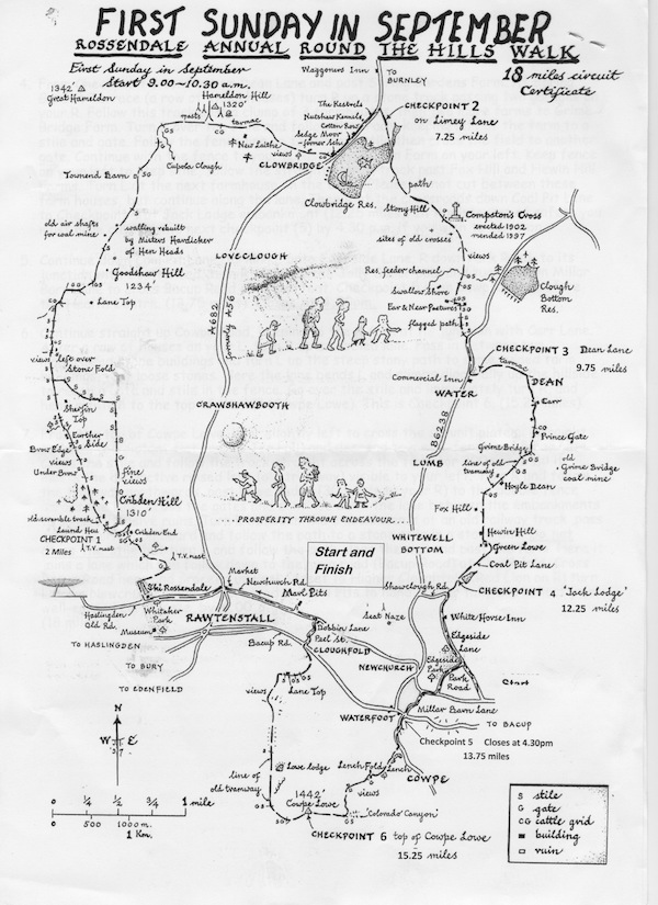
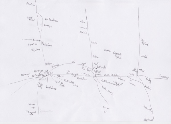
They can, of course, serve multiple functions. This map by the late John B Taylor, local artist and historian, show the route of a traditional community walk, summarises points of interest and is a thing of beauty in its own right. I deeply regret not commissioning him to draw a map of the Springhill area before he passed away.