
August 2014
Postcode predictions
27/08/14 10:15
The 40th anniversary of the postcode triggered a number of articles on the desirability or otherwise of particular postcodes and their role in shaping the identity of a place and, by inference, of the individuals who life there. This made me wonder about the inferences and generalisations based on Springhill’s postcode.
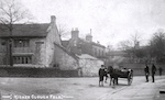
Springhill falls into the postcode BB4 7SP apart from 1,2 & 4 Springhill Cottages which for some bizarre reason are BB4 7SR. Check my area gets off to a good start stating that it comprises “Well-off older couples and families in large detached and semi-detached houses”. Whilst half a dozen or so houses (the new build on the previous farmland) may be described as ‘large detached’ there is not a semi- in the place. The conversion of Springhill House and its outbuildings has lead to a notch-potch of houses joined in apparently random fashion which are technically described as ‘terraced’ but nothing like the typical northern terraced rows.
“The properties are vey large in size’. Whilst there are some sizeable properties there are a similar number of 3 bedroom houses and a tiny 3 room cottage.
Apparently residents are most likely to have a ‘Barclaycard Platinum Purchase’ credit card and a loan from Natwest...I have no idea why they came to this conclusion or on what it is based. Nor have I any idea how accurate it is...but our credit rating is said to be good.
Streetcheck helpfully tells us that here are two more males than females but I have no idea how they reached the total of 180+ of each, given that the postcode comprises only 14 properties and at least one of those is single occupancy...the three houses in BB4 7SR apparently house 110 individuals and even including the ‘census area’ (which they helpfully map) it seems a bit tight. Their ethnic mix is way off and I’ve no idea who the 4 Hindus are. Nor the token Chinese.
I can however believe the crime figures showing two cases of anti-social behaviour.
Whilst these sites and others similar claim to offer postcode-specific data in reality it is aggregated from a larger area or generalised from ‘typical’ profiles. Much of the data is inferred, often from the census This inevitably makes such sites less accurate.
The next layer of analysis is ward, then the lower and middle layer super output areas (definitions here). The LSOA including Springhill is here but includes a number of other areas as well, with a minimum population of 1000. Being Office of National Statistics data these are more accurate...aren’t they?